Sights on Mt. Whitney
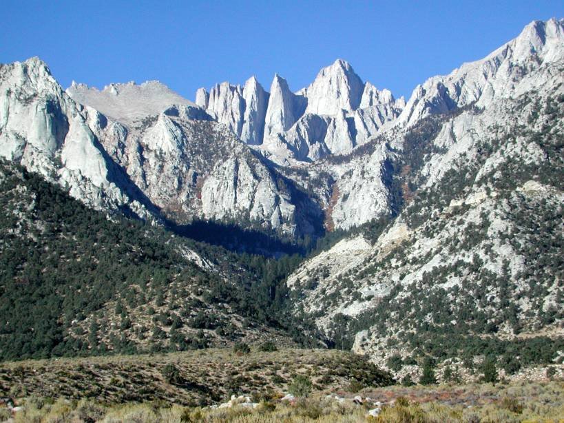
Here I am, out of my winter hibernation and looking ahead at what promises to be a truely exciting summer. The highlight of this summer is going to be an attempt to scale Mt. Whitney, which at 14,505 feet is the tallest peak in the contiguous United States ( the tallest peak in USA being Mt. McKinley in Alaska )
Planning for the trip started way back in January since only a limited number of people are permitted on the Whitney trail every day. That means there is a long drawn application process with the number of applicants far exceeding the daily limit. And then the lottery system comes into play and keeps you guessing until the last moment if you will be one of the lucky ones ( This is sounding so much like this years H1-B process :)) Lady luck was with us this time and we have a day permit for the 8th of July.
So we have about three months of time to prepare for this big hike. Apart from the regular running/gym workouts and climbing a few trails, I think it is important to do few treks at high altitudes. As of now plans are to hike Half Dome ( 8836 feet ) and Mt. Dana (13,061 feet) in Yosemite NP. Each of these treks are challenging on their own and should help us prepare for the big one.
So Mt. Whitney, here we come !!
posted by PD @ 12:47 PM
6 comments
![]()
![]()

6 Comments:
you guys should also plan on spending about half a day at the base camp (forgot what that's called). That will help you get acclimatised. I've heard of people having problems with the altitude.
-Lalith
looks awesome ... and hullo!! are you still going to Yosemite ???
Lalith: Unfortunately we just have a day permit. Which means we have to start very early morning, summit and come back the same day. But since we start our hike to Whitney on Sunday, we hope to do a short trek and spend time at 10,000ft on Saturday.
NJ: Yosemite seems to be packed in May/June, both Half Dome and Dana hinge on getting accomodation in the valley.
sounds excellent! All the best. Have a climber in the office and he mentioned altitude issues too!
Parag, I would check how much snow is left up there this year. My guess is that you would definitely need ice axes or poles, and even crampons if there is more snow. Whitney Portal (the trail head) is about 8000' and there are several 10000'+ areas for you to explore and acclimatize at before Sunday.
Enjoy! And remember, the mountain will be there next year (translation: be safe, turn around in bad weather/altitude sickness).
hi this is Sandeep.Vernekar from EYF(Director Marketing 2008-2009)
This is my request to add me as a moderator in EYF Community. As i didnt have your email id so had to mail u this way.
sandeep.vernekar@gmail.com
Thankyou
Post a Comment
<< Home